Geolocation of Infrastructure Destruction in Cameroon: A Case Study of Kumbo and Kumfutu
Translations:
Geolocation is crucial in open source investigations. In countries in conflict and/or countries under dictatorship, verifying evidence on the ground can be difficult. Video and photographic materials make it possible to have a working knowledge of events occurring out of reach — and it is always important to geolocate such materials.
Cameroon, for example, has a history of government-led attacks on villages. Fighting between military and separatists has seen many Cameroonians displaced or killed. The BBC showed in an open source investigation evidence of villages being burned to the ground by government forces earlier this year.
Footage from various Cameroonian hotspots, namely Cameroon’s anglophone region, show killings, further destruction of villages, and acts of violence towards civilians caught in the middle of fighting.
While we can’t right the wrongs committed against people on the ground, open source investigators are able to analyse the video content to assist reporting and verification of such violent, destructive events.
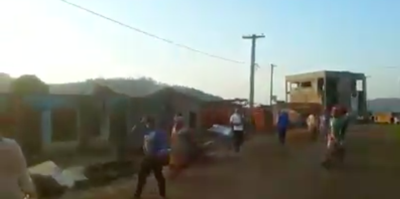
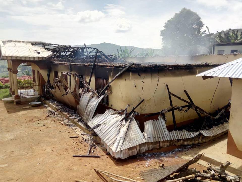
In November of this year, two videos of attacks on Cameroonian villages surfaced on the internet. They showed clear signs of deliberate arson, as there was no indication of surrounding vegetation burning — just individual buildings ablaze. One of the videos, according to its narrator, showed compounds where people were trapped and burned inside.
Both videos were narrated by the people doing the actual filming, as a means of explaining what the video authors were seeing. The case study below explains how we geolocated this grim footage.
Video of Burning Buildings in Kumbo, Cameroon
The first video was filmed in Kumbo, Cameroon, at this location.
The video, as seen below, was provided by investigative journalist Emmanuel Freudenthal, who was been documenting ongoing violence in Cameroon.
Great example of how geolocation and crowdsourcing works to assist investigations. @EmmanuelFreuden needed a video geolocated of buildings that had been burnt – hints were it was Kumbo in Cameroon. The following is how it was found. #Geolocation #OSINT Thread 1/? pic.twitter.com/uAHamh4fNe
— Benjamin Strick (@BenDoBrown) November 16, 2018
Freudenthal approached both Bellingcat and independent open source analysts for assistance in verifying the video. The one clue he immediately had as to the location was that it was filmed recently in the city of Kumbo, Cameroon.
For many, knowing that the video was filmed in this specific area would be enough. But for a thorough verification, and to help with investigating what occurred, a geolocation of the video is a priority task.
The key markers that stood out in the video, those that would reflect on satellite imagery, are as follows.
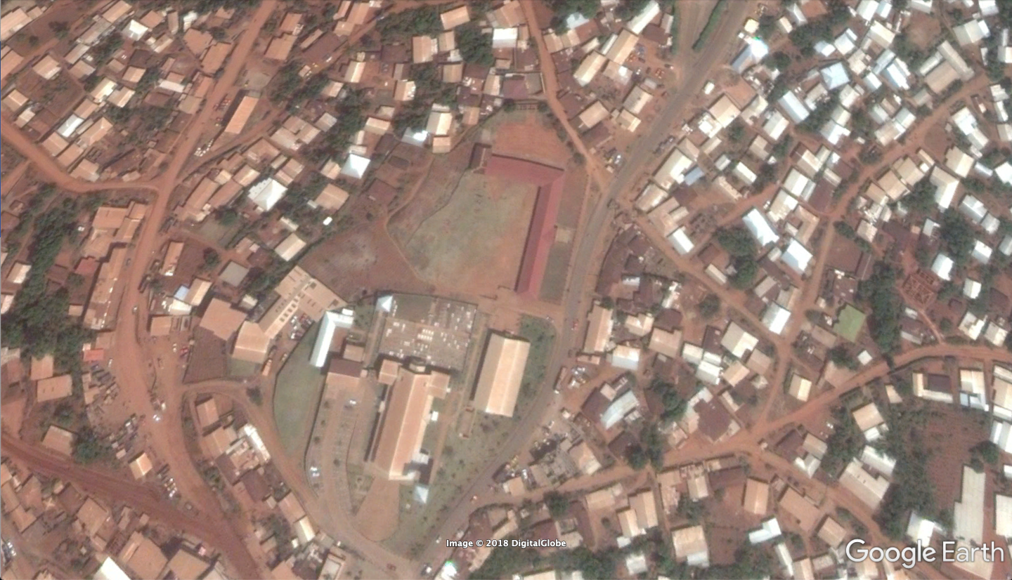
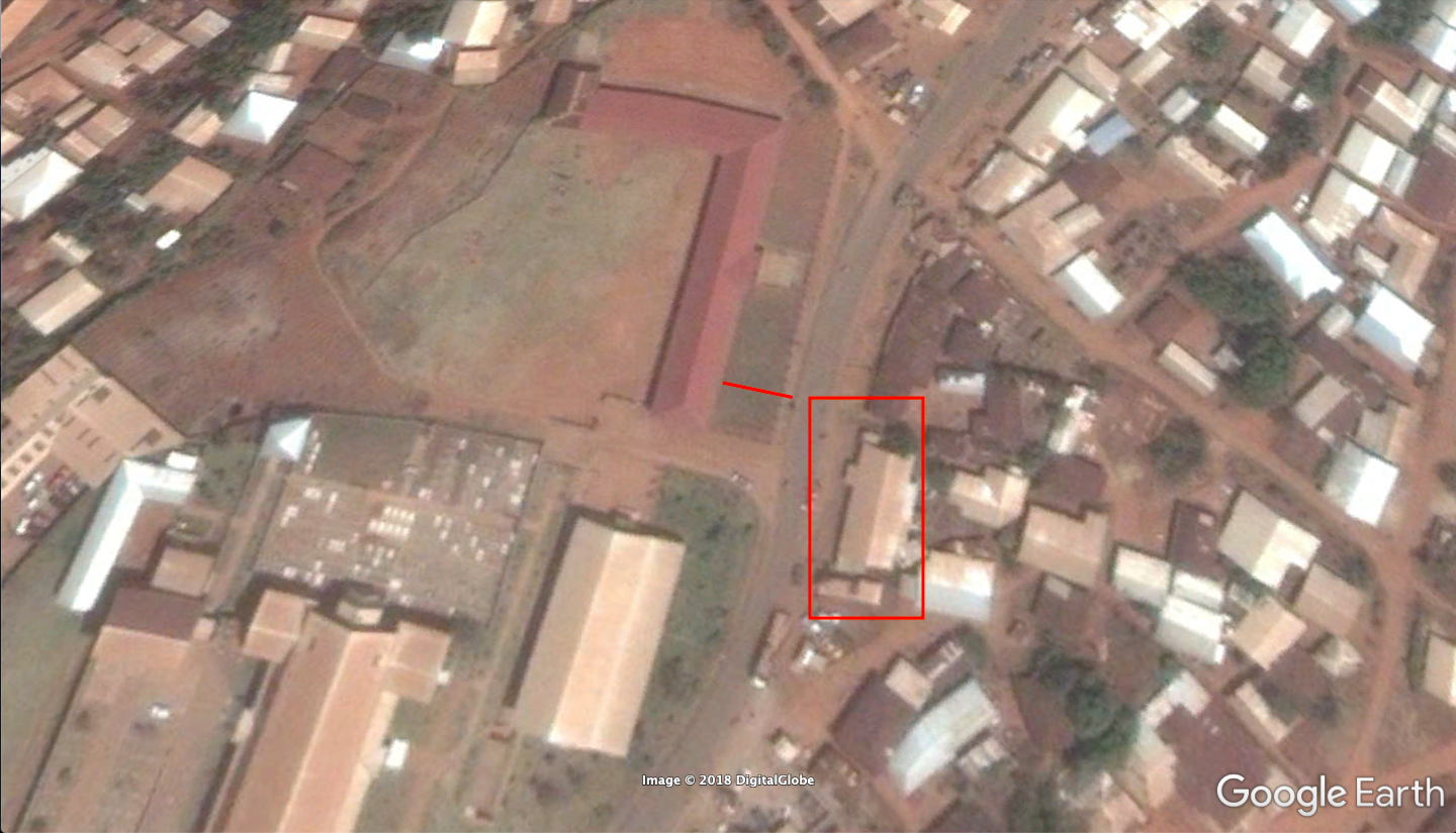
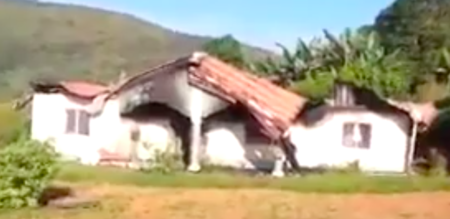
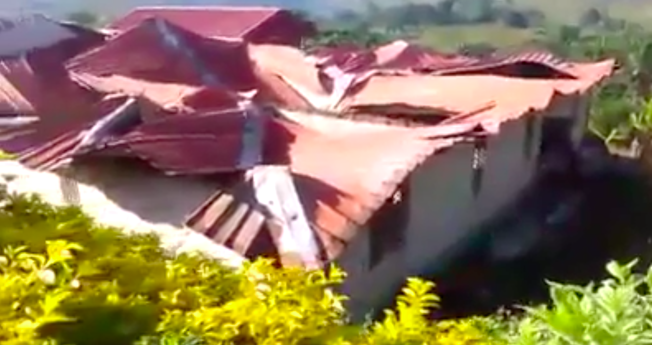
This long red roof next to a road:
These shops and an unfinished building on the other side of the road from the red roof:
After an initial scan through Google Earth, it was clear that with a long red building on one side of the road and shops on the other side, this could be the exact location, as found by open source analyst Sector035.
To further verify the location as an exact match, we checked out other clues in the video. For instance, the name of one of the stores seen in the video is “GPS Bookshop.”
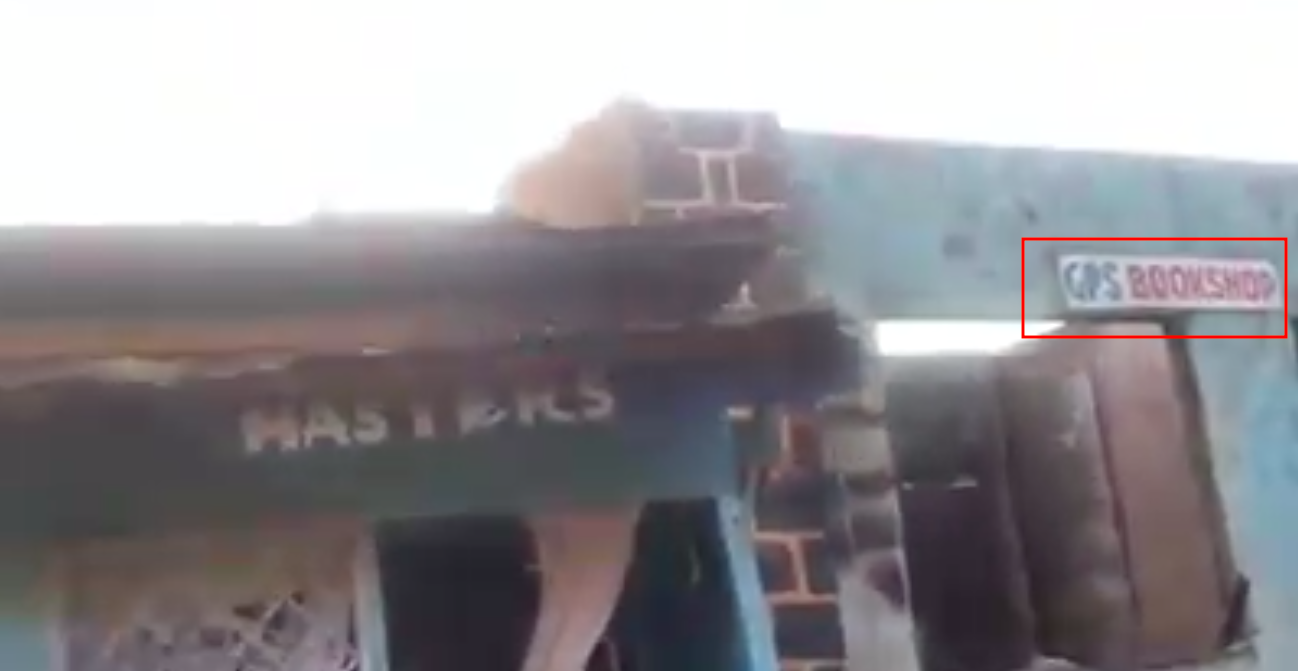
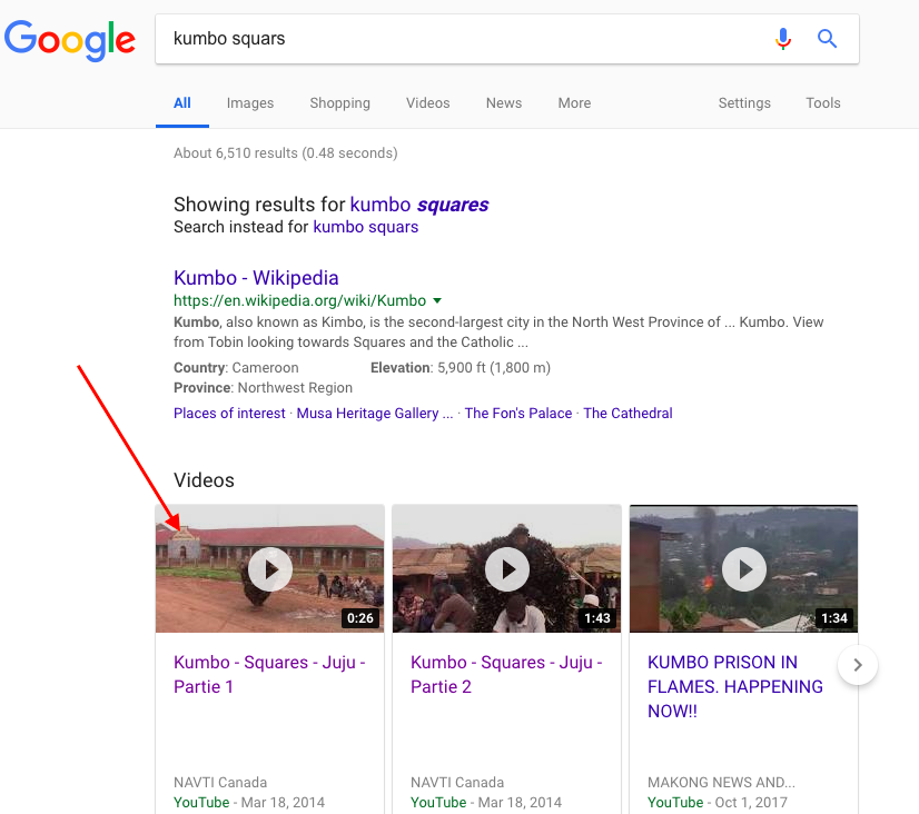
Performing a simple Google Search for “GPS Bookshop” in Kumbo does not yield definitive results, but it does appear that the business is listed on a business registry site.
The registry does not provide much detail, and the only other attached information is “Squars.” In viewing other listings, we conclude that Squars must refer to a geographic location.
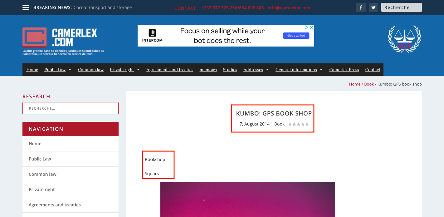
With open source analysis, an important rule of thumb is to “test” information just to see what can come up. In the case of “Squars” in Kumbo, punching it into Google provides the autocorrected search version for Kumbo Squares — a specific area in Kumbo.
From those results, some YouTube videos are listed at the top. The thumbnail of one of those yields an interesting result — the long red building from the original video.
In this video, we can see a type of dance being performed in front of the long red building. Here is a comparison between the building we saw in the video of the torched ruins, and the one we have found via a Google search.
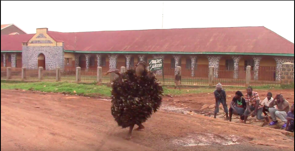
It is apparent that the two buildings are very similar in design, with oval archways, a unique entrance facade, red roof, and black and white stones.
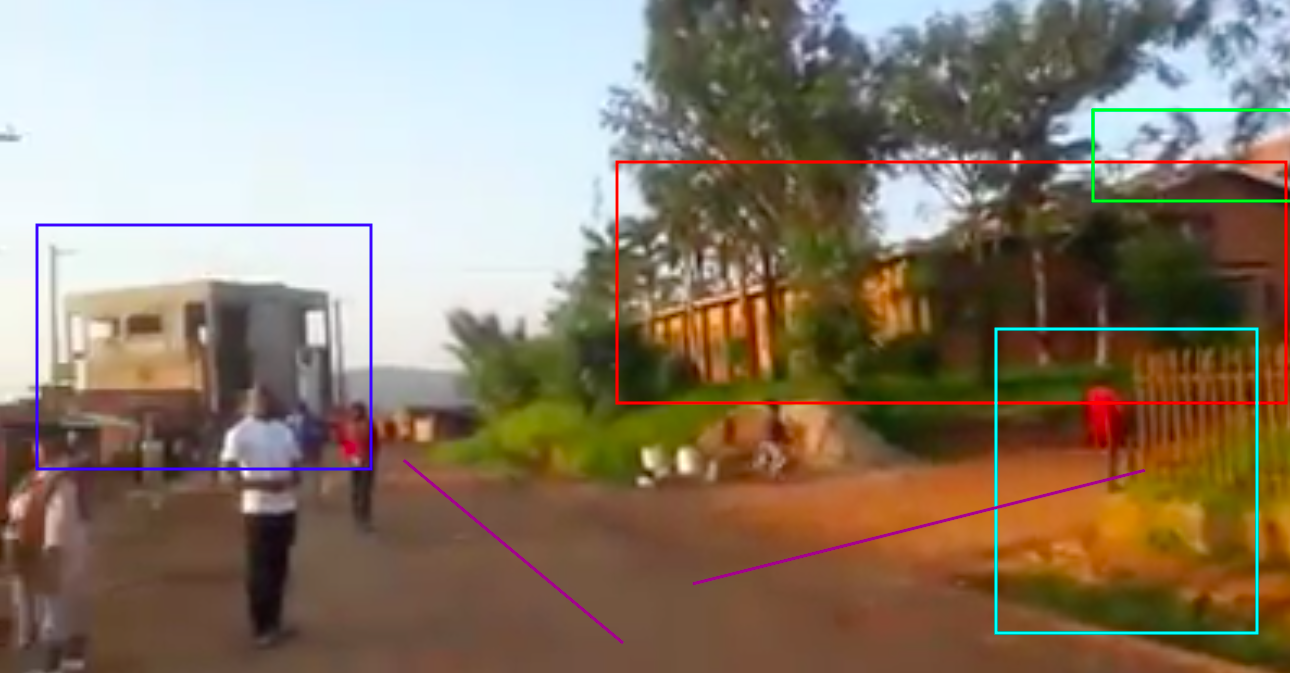
In the second YouTube video from a simple Google search, we can see the same costumed dancer in the same area, but this time from an alternative view — where we can see the other side of the street.
The businesses in the backdrop were filmed with this view of the long red building:
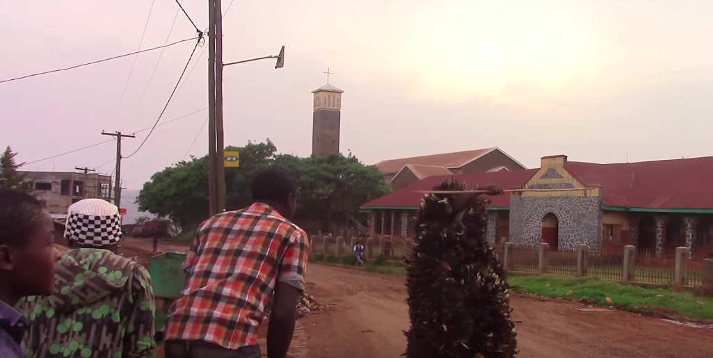
This means that in the YouTube video, the view from the businesses was parallel to the long red building here:
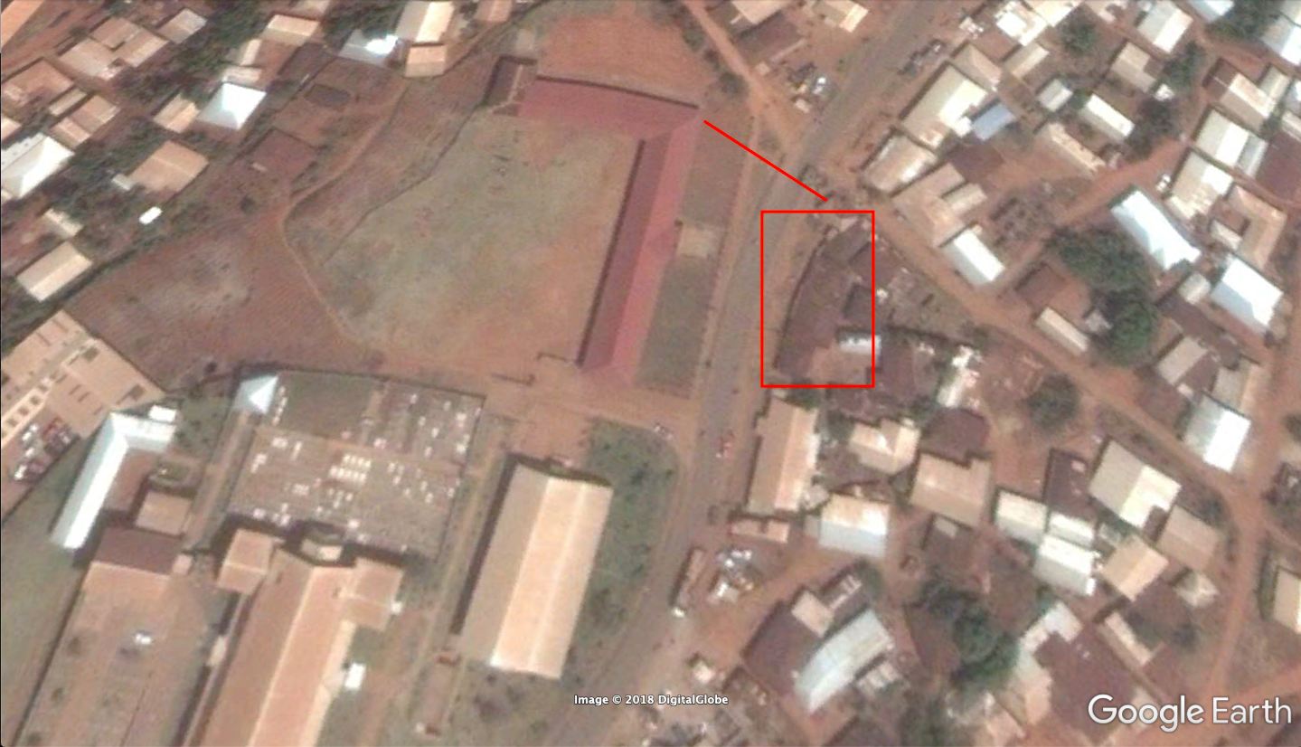
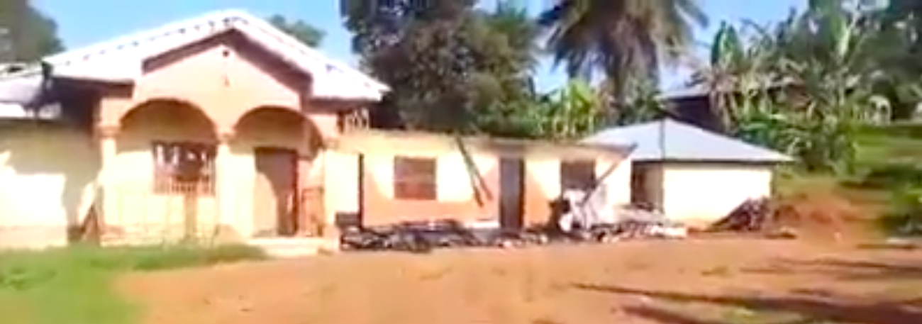
In the video of the burned down businesses, we were shown the long red building from this viewpoint:
Which means the businesses that were destroyed were under this roof:
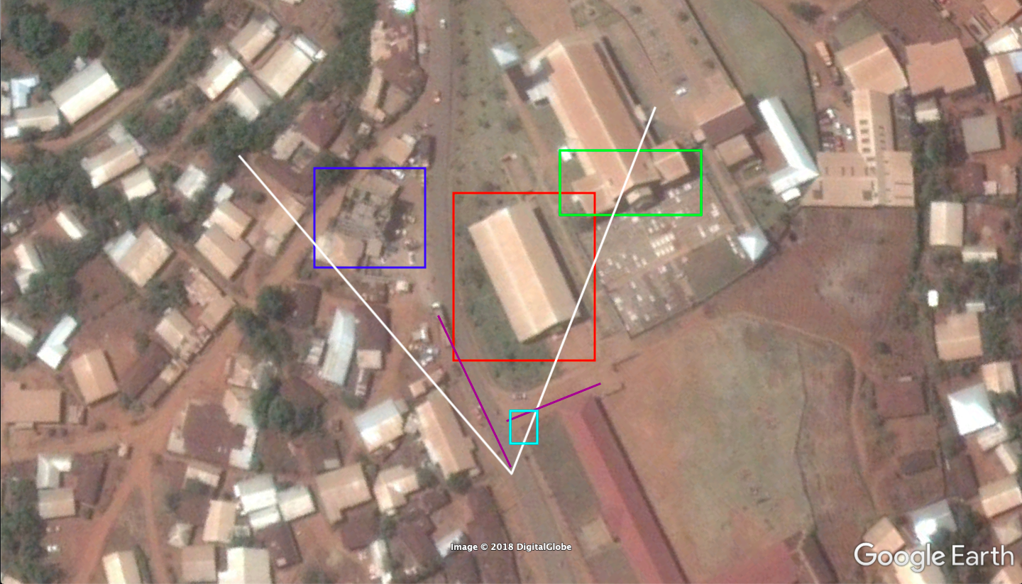
To further establish this location, we have these features from that exact viewpoint:
We can verify their presence on Google Earth from here:
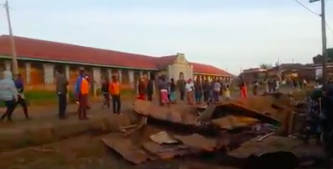
Since I posted these findings on Twitter, a number of Cameroonians have come forward with video and photo evidence of damage to nearby buildings. It is clear that the torching of these stores was not an isolated instance.
Geolocating a Video from Kumfutu, a Village Burned Down in Cameroon
Another video that surfaced recently was that of the village of Kumfutu, also in Cameroon. Kumfutu is 61km from Kumbo, where the previous video was filmed.
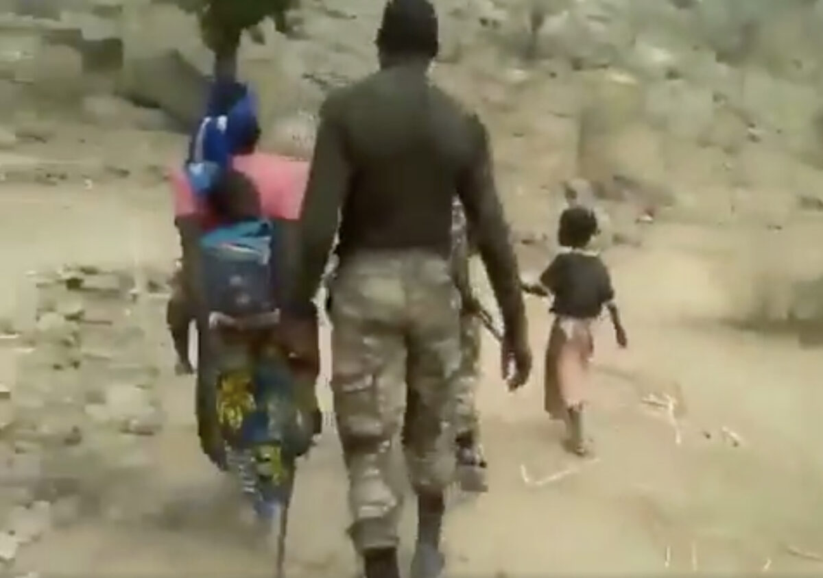
While the previous video did not include evidence of human casualties, the video from Kumfutu came with disturbing photos of charred bodies and injured villagers.
The long version of the second video was a documentation of many buildings that had been destroyed. The narrator talks about what was done to each building. The narrator also says that one of the compounds had human remains in it. At the end of the second video, we see a family whose members had been left homeless.
Here is the video, which was uploaded to a public Cameroonian social group on Facebook (click on embedded tweet to view):
11/ Thanks to open source investigator @y_vdw (who worked on the #BBCAfricaEye Cameroon investigation) we have found out about another devastating event of a village burning in #Cameroon – this time in Kumfutu (https://t.co/HUSuvra4M5) Evidence is in the video ? pic.twitter.com/M1LeeAXwAa
— Benjamin Strick (@BenDoBrown) November 19, 2018
Along with the post came two images of unique building designs:
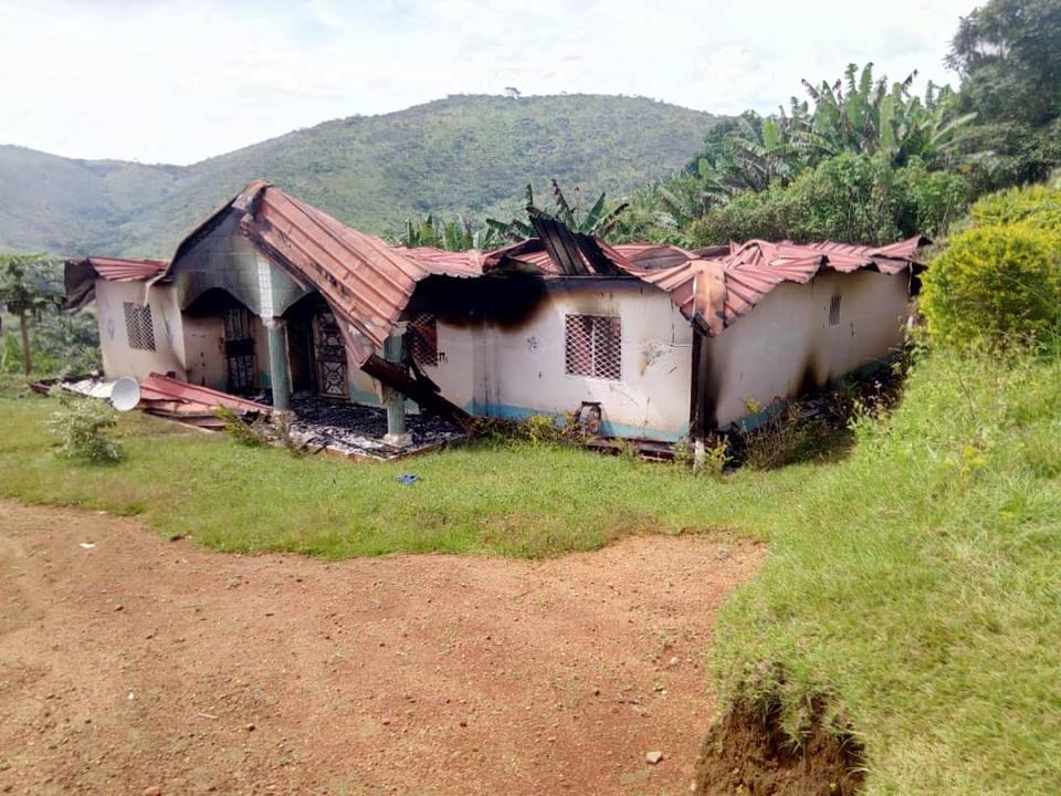
Both have noticeable archway entrances, distinct roofing, and were allegedly located near each other.
In the video, these buildings can be matched to the following scenes:
We can confirm that they are next to each other from the video, as the video author walks up a small hill to film the second house, and proceeds to again show the roof of the first here, in this scene:
Because of the unique design of the first house, and the fact that it has a shed on the left and a long shelter at the rear, it was easy to find a match on Google satellite imagery. The red-roofed house next door is also visible on the map.
Open source analyst Jura Luga verified the other buildings that were destroyed in the video.
These destroyed buildings were shown here:
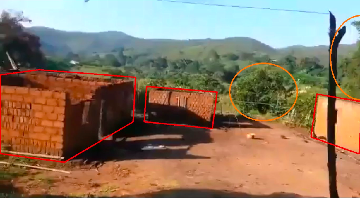
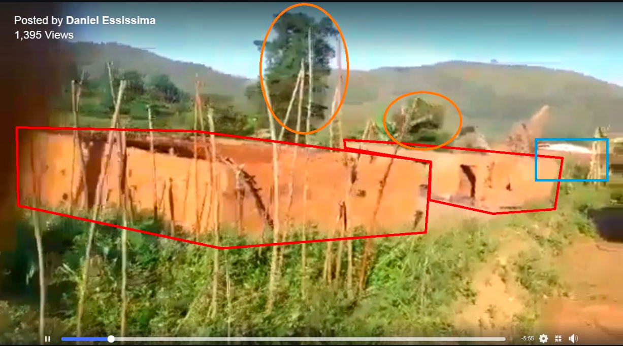
They can be geolocated to here on Google Maps:
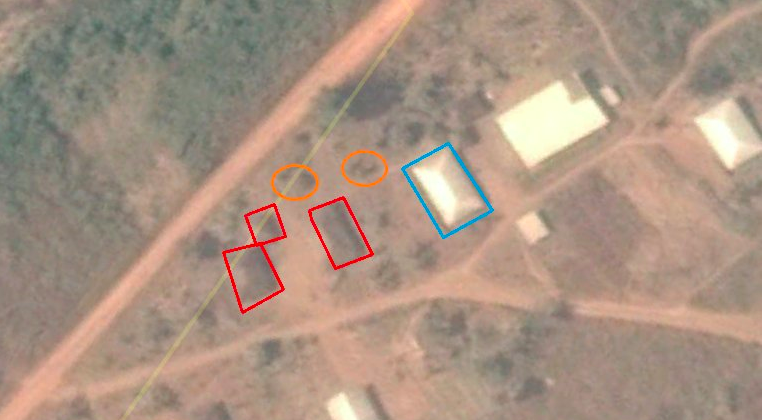
Jura also verified buildings that were destroyed in Kumfutu here and here.
In the video, the narrator said people were trapped in the burned buildings shown here:
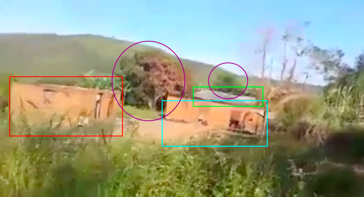
These buildings are located here on Google Maps:
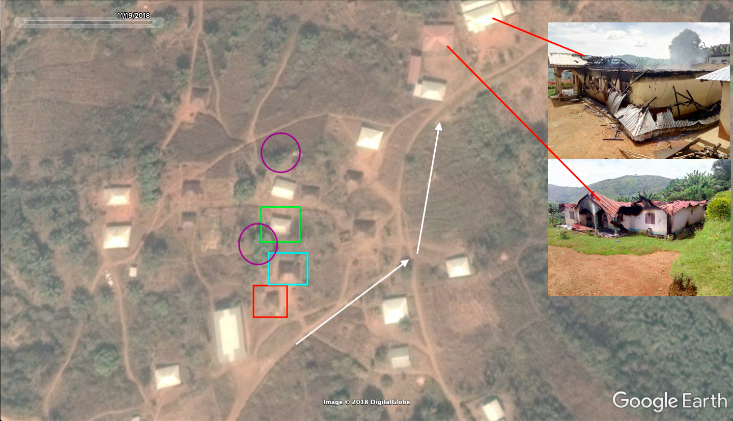
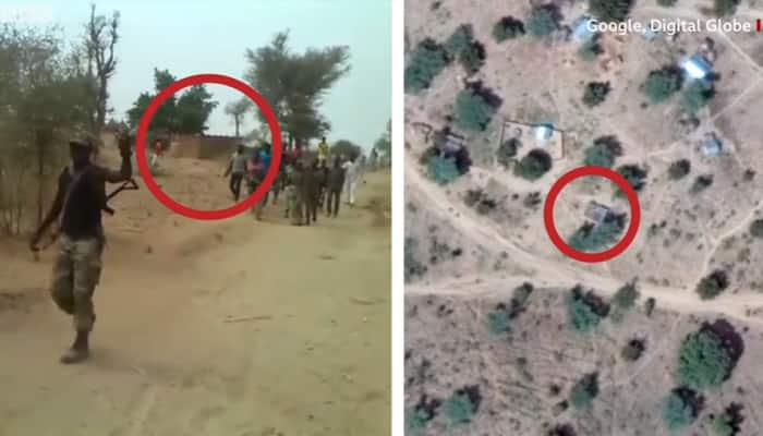
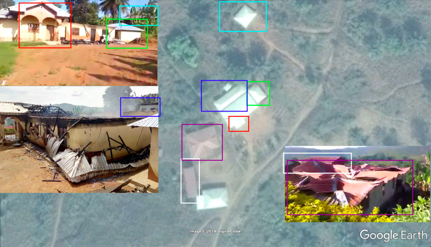
Having taken into consideration the locations of the buildings, and with the differences between the buildings (pre and post-destruction) on available satellite imagery from Digital Globe, open source analyst Nathan Ruser demonstrated that these villages had been destroyed in Kumfutu between October 26 and November 11, 2018 (as seen below):
In Kumfutu, the houses highlighted in red were destroyed or damaged in fire between Oct 26th and Nov 11th. pic.twitter.com/DHXZCPznfj
— Nathan Ruser (@Nrg8000) November 20, 2018
The red indicates buildings which were either completely, or partially, destroyed in the near-complete destruction of Kumfutu.
Context to Cameroonian Village Burnings
Previous open source investigations have shown that the Cameroon military has systematically burned villages to the ground in Cameroon’s anglophone region, as you can see in the video Cameroon Burning.
Further proof of atrocities committed by the military can be seen in another open source investigation on Cameroonian extra-judicial killings, which also involved many of the analysts and investigators in this case study.
Bellingcat’s research for this publication was supported by PAX for Peace.
![]()